
| Lakes Home | Walking Home |
Lake District 23rd to 25th April 2012
Quick links (all on this page)
Monday: Pillar via Black Sail Pass
Tuesday: Scafell via Burnmoor Tarn, back via Mickledore
Wednesday: Sprinkling Tarn via Styhead Tarn
Introduction
First, for this trip I moved bases. All my other trips to the lakes have been based in Ambleside, which I like for the central location, and the many amenities. But it's hard to reach the more Western fells from there, so this trip was based in Wasdale Head, staying at the Wasdale Head Inn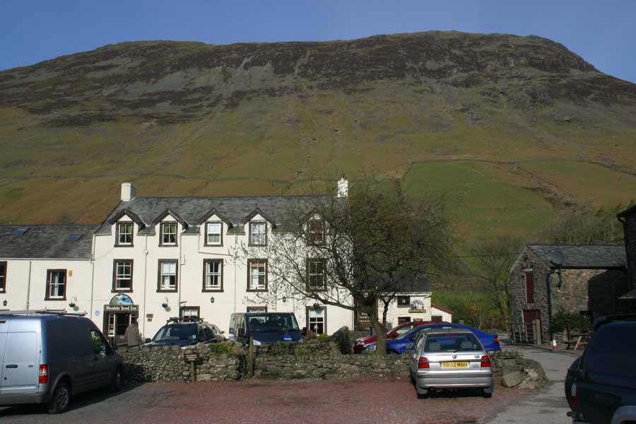
It's a nice place, with great beer and excellent customer services, but it really is in the back of nowhere. There's no mobile phone reception for instance, and if you don't fancy the food at the In then it's several miles until you find anywhere else. But it's a great base for peaks I was after, primarily Pillar and Scafell (I've done Scafell Pike).
Second, this trip was cut short: it was supposed to be Monday to Friday walking, but I went home on the Thursday. For a start, my knees were killing me more than usual: I'd started with two big walks (for me anyway) and it always takes a few days for the tendons around my knees to loosen up. It's those that are the problem, rather than the joints themselves. If it had just been old age aches and pains that would have been fine, but the weather turned very nasty. I can tolerate rain (you wouldn't do much walking in the Lakes if you couldn't), but the forecast was for winds of constant 25mph, and gusting 40mph or more in the fell tops. That's far beyond my fun threshold. Wednesday was pretty bad, with serious gusts as I came around Toad How, but that was a prediction for a lot worse. It's odd (if unsurprising) how much the weather affects how you feel about hill walking. Well, affects me anyway. If the weather is really bad then I tend to spend the whole time thinking: "Why am I doing this?" Which takes an element of enjoyment out of it. Anyway, on with the walking.
Monday 23th
This walk is another one to complete a collection. As I I've said before, I'm an unashamed peak-bagger, and today I was after Pillar, one of three peaks out of the highest ten which I haven't done. The walk was a very simple one from Wasdale Head: up Mosedale and then up Black Sail Pass to the ridge, turn left, then over Looking Stead along the ridge to the top of Pillar at 892m. I had thought about carrying on across Wind Gap on towards Scoat Fell, but decided that was a bit much for day one. One of things about Wasdale Head, compared to my usual start points, is that you can see the summit of your destination pretty much from when you start out. You have to walk a little way up Wasdale and over a nice old bridge: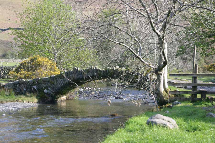
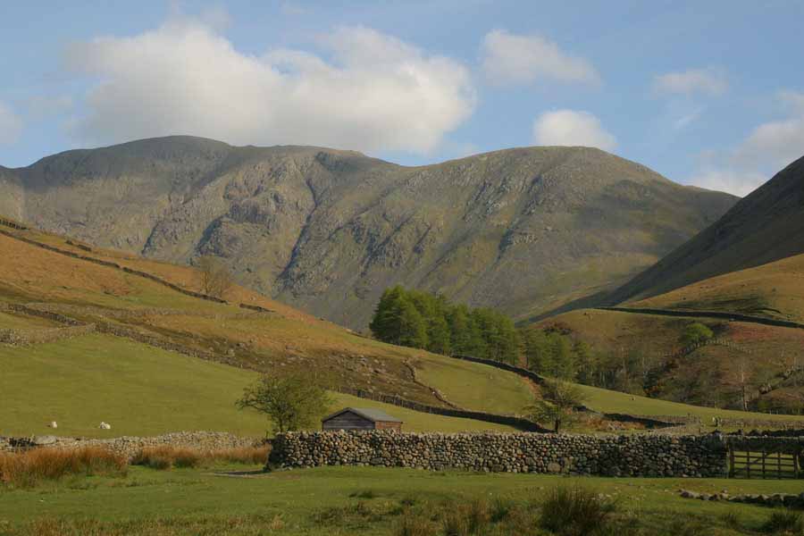
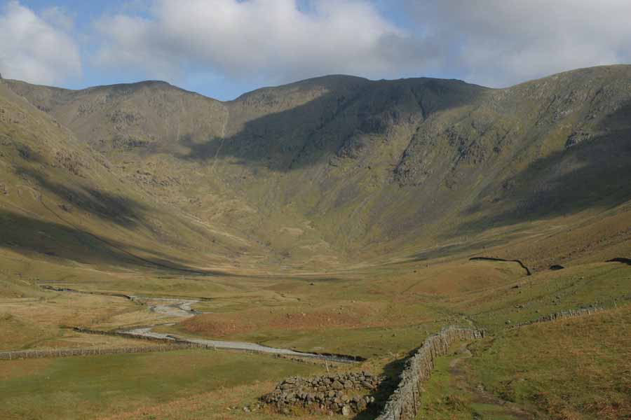
Then you can see past Yewbarrow (that's the big hill behind the Inn in the photo above), and up Mosedale, with Pillar looming over it. Black Sail pass is around to the right, behind that shoulder (park of Kirk Fell). The peak on the right at the back is Looking Stead (627m), and I'll be walking along the top of that ridge as far as the highest bit on the left. The ridge actually angles away from me at that point, so the rise in height along the ridge looks smaller than it really is.
A bit further up Mosedale, and the view back towards Wasdale Head looks like this:
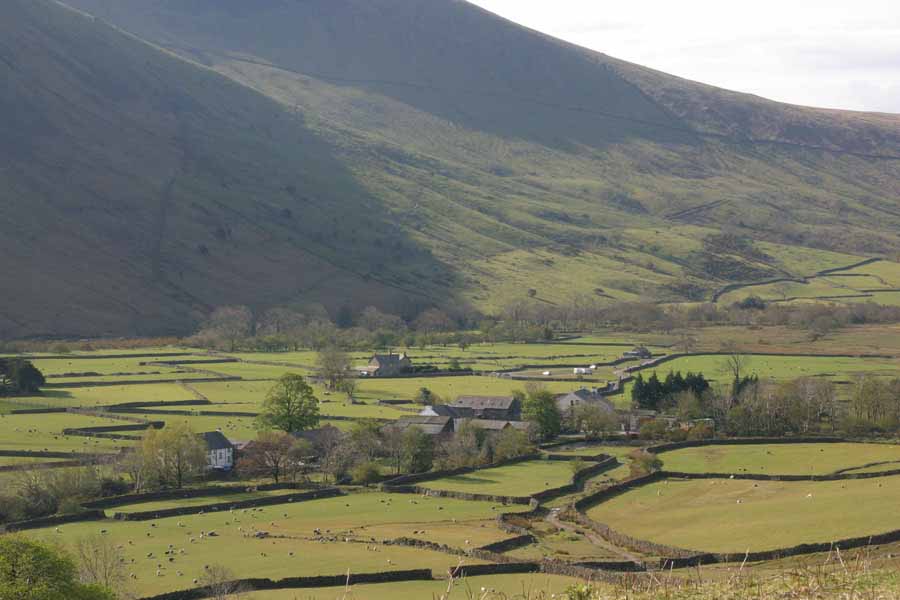
Those building are the whole of Wasdale Head: the Inn is last building on the right in the middle ground. The ridge in the background is the run up to Scafell - see tomorrow's walk for more details etc. From further up, the view up Mosedale is clearer, here showing Pillar just right of centre, with the v-groove of Wind Gap to the left, and Scoat Fell to the left of that.
Looking further left, this is the end of Yewbarrow, and the ridge running towards Red Pike, which is out of sight to the right.
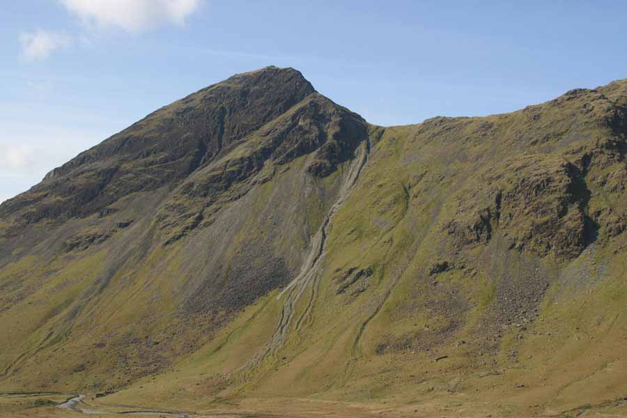
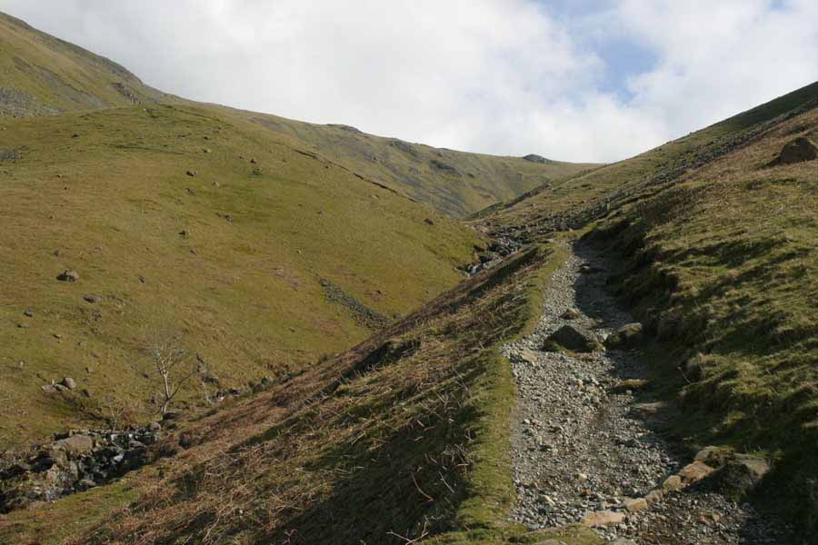
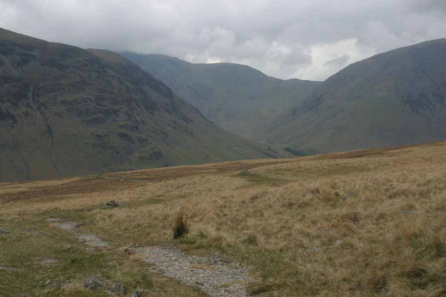
And this is where I'm heading: up Black Sail Pass. You can see the ridge at the top.
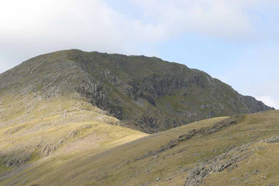
Then, once at the top of the ridge of Black Sail Pass, this is the view up towards Pillar. Now you can see how much the ridge curved back in that earlier picture. The perspective is odd, so it's hard to work out which bit is the highest. It's definitely not the bit which appears highest, as that's a buttress 40m below the summit. As you'll see in the picture after, it gets a bit rocky towards the top. Not scrambling territory, but still a bit lumpy.
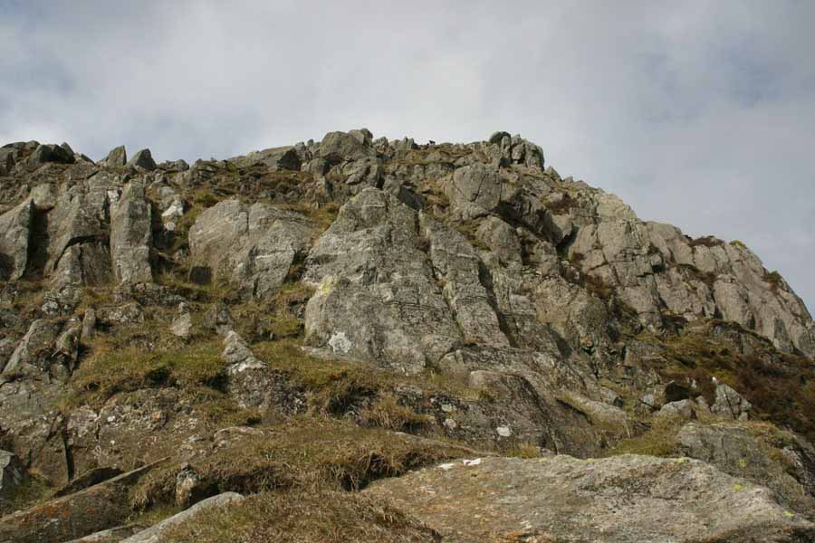
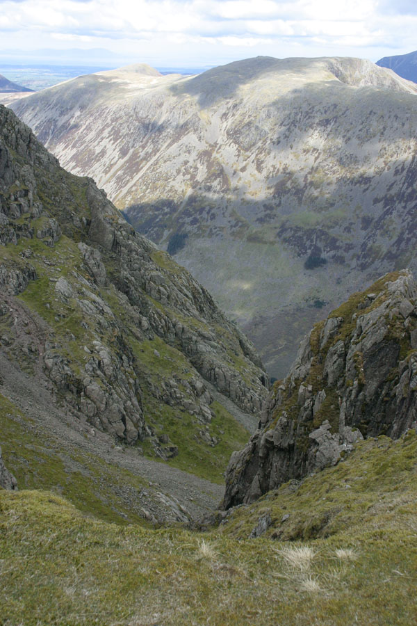
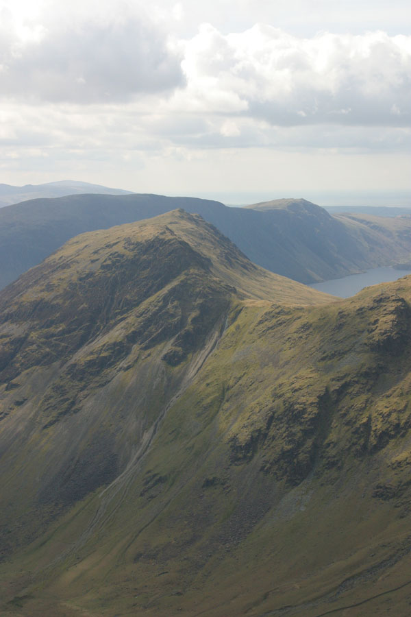
Closer to the top, and a couple more pictures. The first is the view towards the summit. This time you can just make out the cairn which (as is traditional) marks the top. As you can see, despite being mid-spring, there's still old snow. The weather was sunny, but the temperature down in the valley was about 10oC, so the peaks were at or below zero. After that is a view down a typical Lakes scree gully (Hind Cove I think). Bear that slope in mind when I talk about Scafell on tomorrow's walk. The peak in the background is High Crag. The third picture is over the summit of Yewbarrow, with Wast Water in the background.
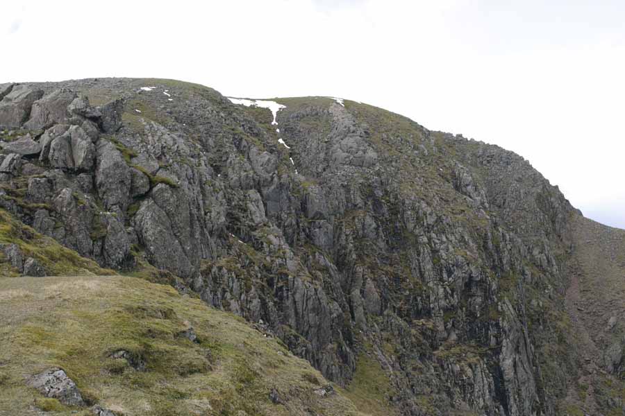
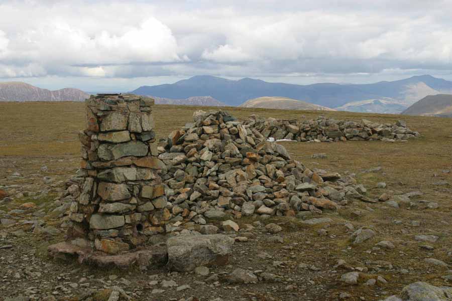
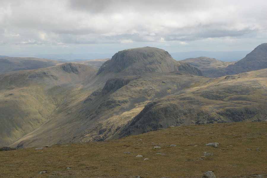
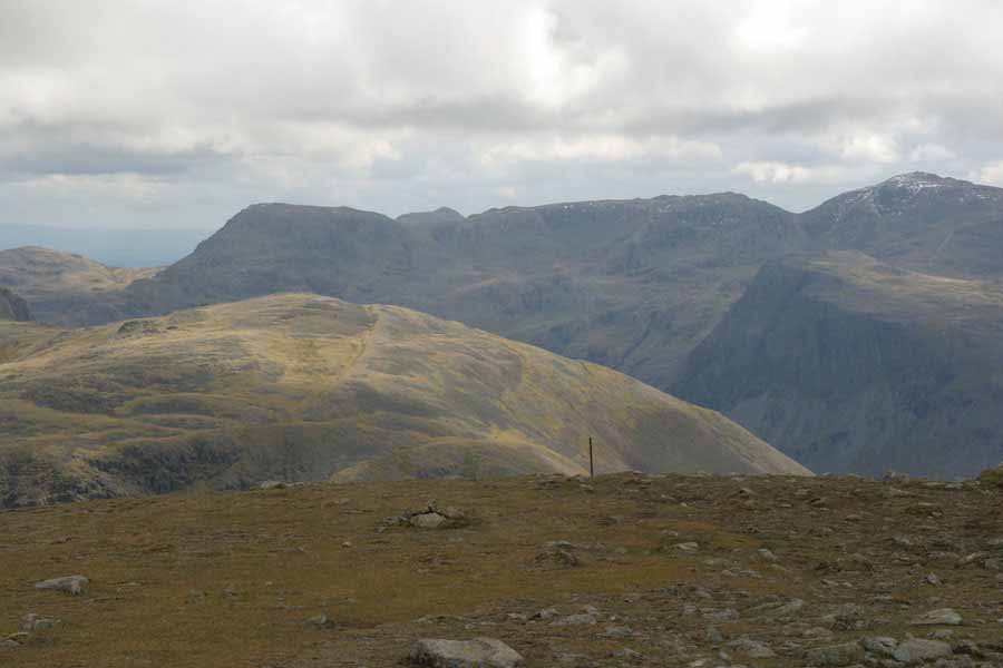
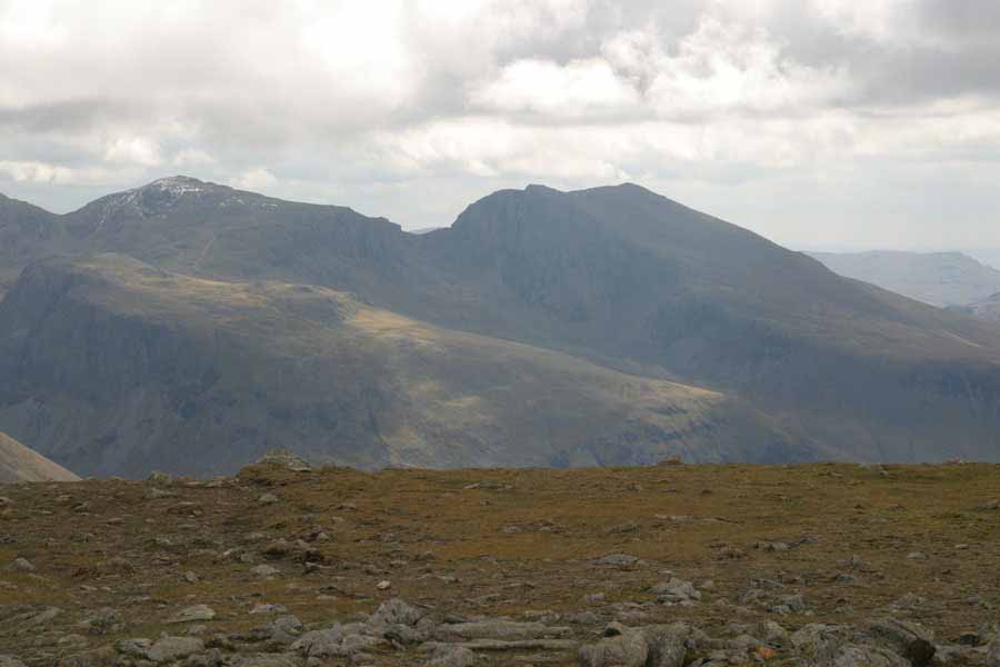
Finally, the top. To celebrate, the trig point at the summit, plus some views. The three picture stitch together, and show the view north and to the east. First is Great Gable, then the ridge running from Great End, across Broad Crag, and then down and up to Scafell Pike (with a fair bit of snow). The last is the two Scafells, with the ridge of Mickledore between them. Mickledore is the gap. Take a look at the slope you can see running from that ridge towards the camera. We shall be hearing more of that.
After that, it was back to the Wasdale Head Inn via the same route.
Tuesday 24th
Tuesday's walk was to bag the main peak which had so far eluded me: Scafell. I did Scafell Pike a couple of years ago, but the one time I tried to walk up Scafell I had to give up halfway there because the ground was hideously soft underfoot and it was clearly going to take far longer than I thought - or thought comfortable. That attempt had been from Wha House Farm on the bottom of Hardnott Pass, which was a long trek. This time I was starting much closer, but going a slightly roundabout route. From Wasdale Head the short way is just up Lingmell Gill to Mickledore, and then try to find a way to the top which doesn't involve Broad Stand. I planned a somewhat easier route: head south to Burnmoor Tarn, then swing northeast and follow the ridge. This is just about the easiest way up, but as I've said before, getting fit for hill climbing is hard when you live in the Fens.As I said earlier, walking from Wasdale Head means that peaks are usually visible when you start. So here's Scafell in the background, peering out from behind Lingmell out of sight on the left. As you can see, the weather has got worse. It's about the same temperature as Monday, but the lack of sun makes it feel colder. Cloud base is a little below the peak tops.

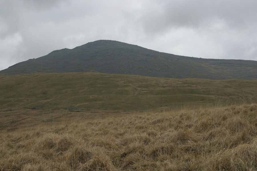
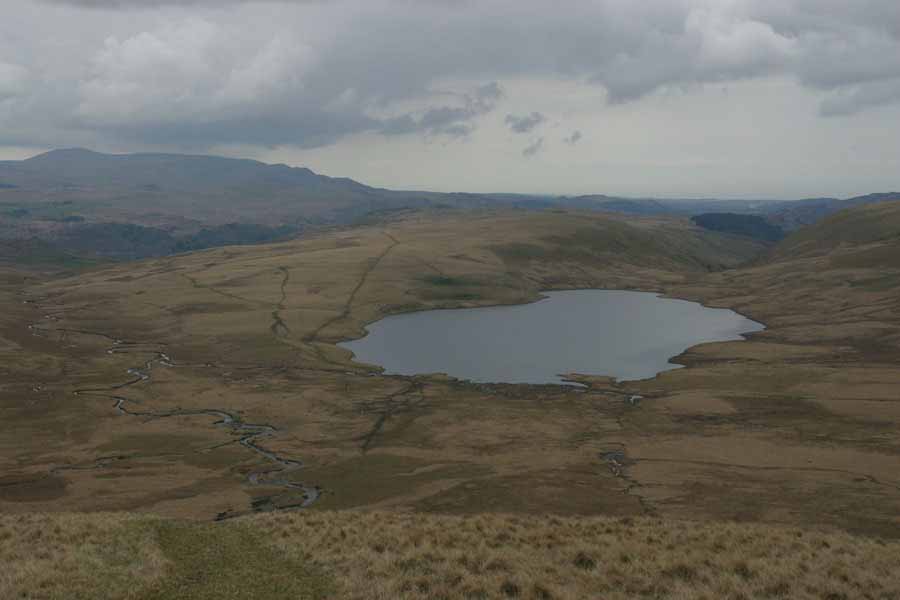
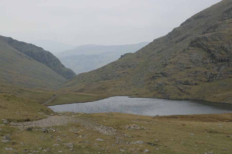
The walk for the most part was fairly sensible. Once on Eskdale Moor I actually cut the corner rather than descend to Burnmoor Tarn and climb back up again. A couple following me did the same, I noticed. This is the view back from the low part of the ridge: the tarn is off to the left out of shot. The next shot is the view up to the summit. As I said, this is the easy way up, if you compare earlier views from other directions. Thirdly, the tarn itself.
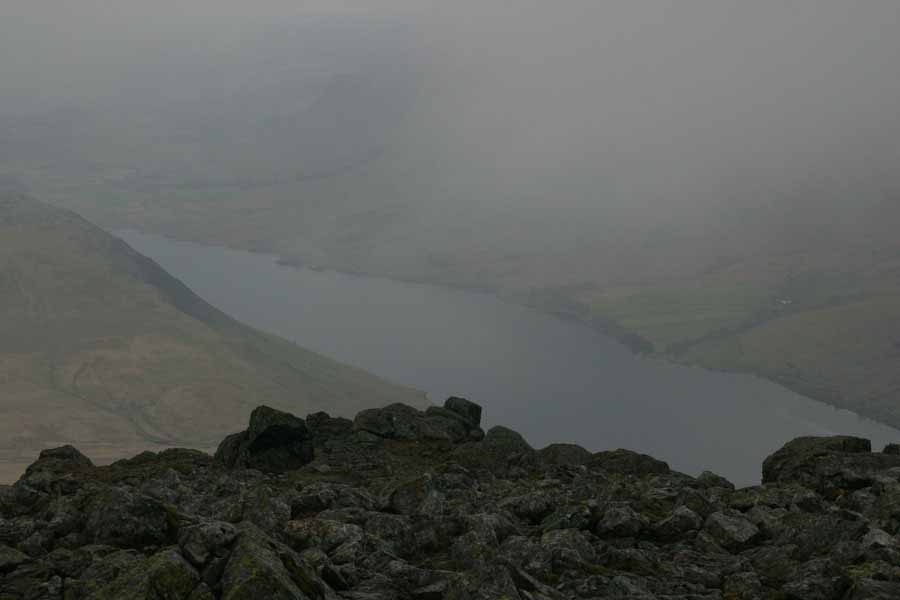
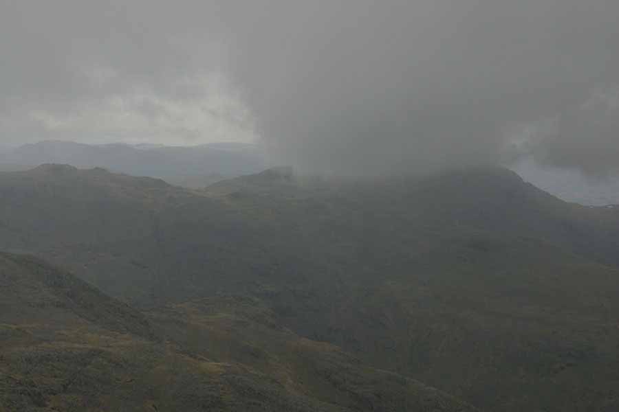
The views didn't really change a lot after that, so there are no more pictures. Once I got to the top, the view was better, but somewhat spoiled by the low cloud. And the snow, which kept starting and stopping. Down in the valleys it was falling as rain, but the fell tops were below zero, so it was snowing. This is all I could get between gaps in the cloud: the view down to Wast Water, and then the view east towards Bowfell - the bit under all that cloud.
At this point I had a great idea. Yes, you can cringe now. Originally I'd planned to go back the way I came, but when I looked at the OS map it looked like I could cut a fair corner off, by going back a route similar to the one I mentioned earlier, down Lingmell Gill. There's one small fly in this ointment, and it's called Broad Stand. That's the way down to Mickledore, where the path is, from the summit of Scafell. It's one of the most common spots for accidents in the Lakes. In fact, I hadn't even looked at that, but decided to go down the slope towards Foxes Tarn, follow the path around, then back up to Mickledore. Once there, it would be down the slope to Lingmell Gill. Looks easy on a map - it's not even very far. The down-side is that most of it is on forty-five degree scree slopes. You lose about two hundred and sixty metres of altitude, then have to regain about two hundred of it again. On loose scree. In occasional snow. A couple of bits down are so steep it's safest to descend on your backside. I find going down that sort of slop far worse than coming up, as it's harder to control your speed. But after a loooonnnngggg time I made it. The bit I had to climb looked like this:
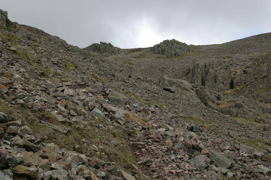
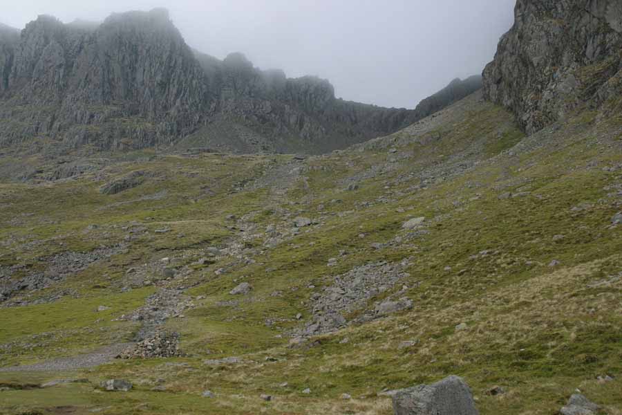
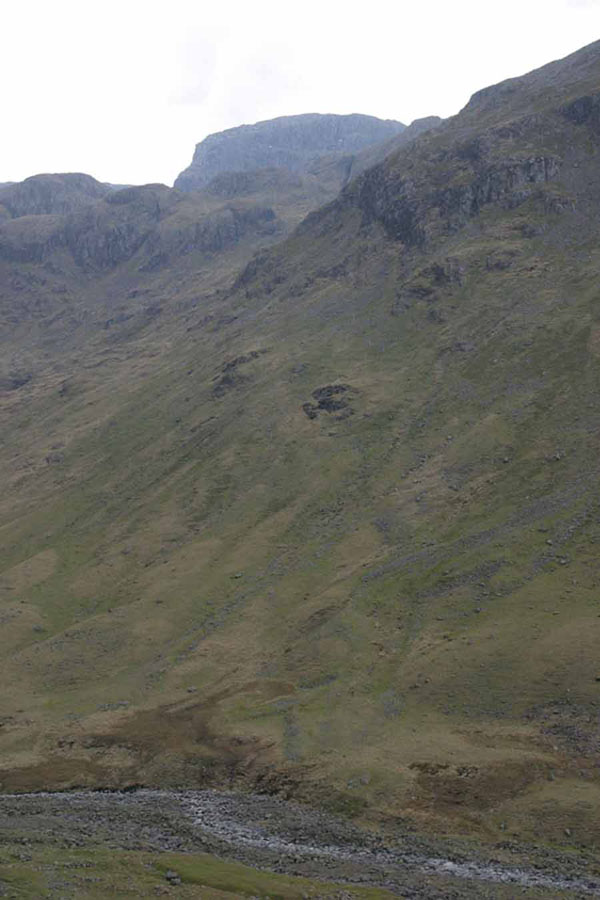
Now, do you remember on the bit from Monday, where I said: take a look at that slope coming down from Mickledore, and we'll be coming back to that? Yep, that's the next bit I had to do. Yes, it's very steep - even steeper than the bit down to Foxes Tarn at the top. Yes, it's all loose scree, which shifts underfoot. But I managed to get down that without slipping, and after a hundred metres or so vertically, it levels out a bit. Looking back up, you see the view below. My way down started at the deep "V" in the ridge. I don't have a picture looking down it (it was still covered in cloud at that point) but the picture I mentioned earlier showing a gully on Pillar gives you an idea. Except it was steeper.
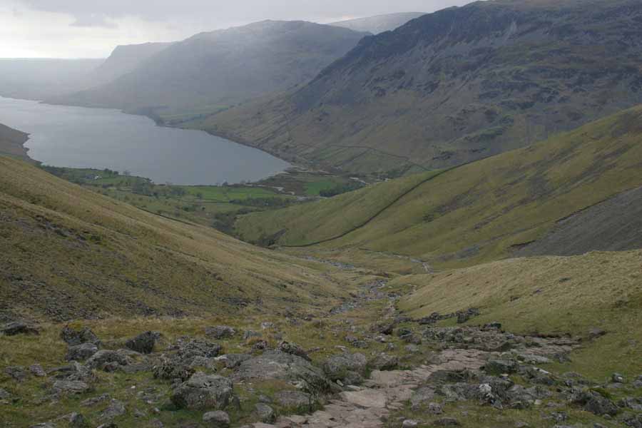
Once on the normally steep bit, rather than the silly bit, it's a straight walk down to Wasdale Head, around the flank of Lingmell:
Wednesday 25th
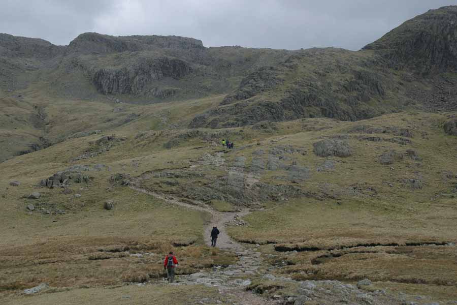
As I mentioned in the intro, by now my knees were a bit shot (must avoid "arrow in the knee" jokes...) and the weather was getting very gusty. So I decided to do a lowish walk, up to at least Styhead Tarn, and then maybe onto Sprinkling Tarn if my knees help up. The path is easy to see, even in heavy overcast: here it us, running up the flank of Great Gable: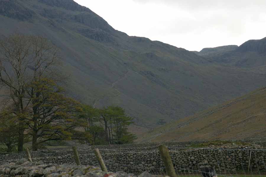
And there, lurking behind the lower slopes of Lingmell, is I think, Scafell.
Then, around the corner, the campers favourite: Styhead Tarn. I did run into some people on Scafell who had been camped there the previous night, but there was no-one camping this day. The wind was gusting pretty strongly across the tarn, as this is an obvious gap in the high fells around it.
From here I turned right, and headed up the path below Great End to Sprinkling Tarn.
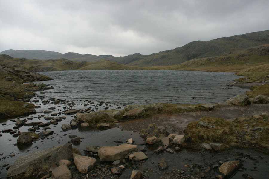
And that was it. Next day I drove back to face again the joys of job applications. That morning the weather was horizontal very heavy rain, so I wasn't heart-broken.